Congregational Studies... Church Health... Mission Audit... call it what you will, it always begins with getting to know you patch, and that's what I am concentrating on just now (just as I did in Glasgow and Leicestershire way back when).
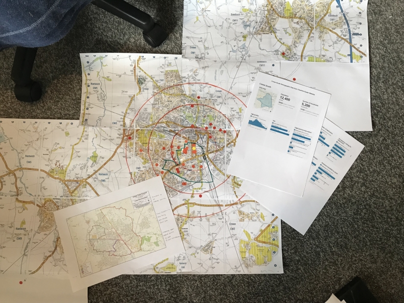
Paper maps are largely a thing of the past, so it was a good challenge to scan, print and assemble a map from an old (but not too old) street atlas given to me by someone who no longer uses it. Add blobs for the church (yellow) where people live (red), find the ward map for the local council (green outline on my map) and then the demographic information.
If we are to start in 'Jersualem' then first we need to define it... Do I/we centre on the church building (around which I have drawn 05, 1.0 and 1.5 mile rongs)? Do I/we centre on the council ward? or the town a a whole?
And what else should I be mapping... I have ideas but I want to get others to join in the work so that there is ownership and understanding..
